D1
Guttannen → Windegghütte
Departure above Guttannen, climb via the Rindertal and the Furtwangsattel (2568 m) to the Windegghütte.
10.1 kmD+ 1460 mD− 730 m
Trip journal
A ski circuit in the Uri Alps
End of March 2025·5 days·72.0 km·D+ 6670 m·D− 7720 m
Five days of loop crossing in the Uri Alps, between Guttannen and Innertkirchen: two guarded huts (Windegghütte, Spannorthütte), one night at the Steingletscher hotel at the foot of the Sustenpass, one night at the Grassen bivouac, and a final day which closes the loop via the Wissberg, Engelberg and the Jochpass, then the descent of the Gental.
Information
Itinerary
From Guttannen to Innertkirchen, a loop from hut to hut (and a bivouac) between the Dammastock and Titlis massifs.
Interactive map — zoom deliberately limited.
Departure above Guttannen, climb via the Rindertal and the Furtwangsattel (2568 m) to the Windegghütte.
10.1 kmD+ 1460 mD− 730 m
Via the Triftbrücke and the pass to the west of the Giglistock (2901 m), descent from the Gigligletscher to the Steingletscher hotel.
11.4 kmD+ 1240 mD− 1260 m
Climb via the Obertaljoch, then the Wendengletscher in the fog, to the Grassen bivouac.
9.4 kmD+ 1510 mD− 720 m
Climb to the summit of Grassen (2946 m), crossed by the Bärenhorn above a sea of clouds, to the Spannorthütte.
12.6 kmD+ 1130 mD− 1810 m
Ascent to the Wissberg cross (2627 m), descent to Engelberg, bus and cable car to Jochpass, then long descent through Gental to Innertkirchen.
28.5 kmD+ 1330 mD− 3200 m
The story
Traffic jams in Geneva, then in Lausanne, coffee in Yverdon, break to pack bags and leave a bag of food with the owner of Steingletscher in Meiringen, drop off a car in the Gental valley for 40 fr. the week, then look for a non-prohibited access road to go as high as possible by car. After several attempts, negotiation of a free place slightly above Guttannen with farmers.
So much so that it is not very early when we attack the first picnic, and even later when we attack the climb in sneakers, skis on our backs. We come across an elder in a Duster who insists on showing us the start of the path, although we tried to tell him that we had the map. But he seemed so excited to see a group of young skiers…
After 500 m on foot, we finally put on our skis to go up through soft snow along the Rindertal, then, in the sunset lights, to the Furtwangsattel. With a nice scraping session, we reach the slopes overlooking the Windegghütte, regularly crusty then becoming more and more supportive as we go down.
A small winter cabin, very comfortable, with a wood stove and wood that we will be slow to find!
The CSV from the day before alerted us to the steep and potentially hard and exposed slopes which allow us to leave the cabin at the bottom. We reach the impressive Tibetan Triftbrücke bridge, attraction at the start of the day.
The long valley that we then climb up inspires us to take a coffee break, lying in the grass, lulled by the sound of the stream. The break already at the pass to the west of the Giglistock will cost us visibility during the descent of the Gigligletscher…
The snow gets heavier as we lose altitude, so much so that we prefer to scrape along the crossing at the end rather than risk turns. We then go up the canyon to Steingletscher, where Thomas welcomes us very warmly.
Afterwards belote, chill and chat with Daniel Dulac who I hadn't met for a long time. It's good, the comfort of a good hot shower, sometimes, in the middle of a trip to ski touring. And also to be served food and to open the tap to get water!
The filthy day of the week. It was announced from the start, and the models were not mistaken...
We leave under a thick layer of fog, in which we soon find ourselves. The snow is softened. At the Obertaljoch pass, we discuss which option we take on the descent: steep and due north, or less steep and west. Some doubt the slope and, without hesitation, we switch to the left.
The snow that fell the previous days is placed on a hard bottom, and the whole is homogeneous and quite pleasant to ski. Except for the poor visibility. I opt for an intermediate option, and we soon dive to the right, to find the cold side. We find ourselves on a steep slope, in which we have no choice but to repaint.
The ascent of the Wendengletscher takes place in thick fog, conditions which make the small Grassen bivouac, perched high on the ridge dominated by the imposing wall of the Titlis, all the more welcoming.
We will spend the afternoon and evening warmed by the wood fire, listening to the wind and snow whipping the walls of the bivouac.
Up at 6 a.m., hoping to enjoy the sunrise. We are disillusioned by seeing the different layers of clouds and fog at all altitudes. I decide to procrastinate.
But an hour later, everything seems to change very quickly, and we rush to leave as soon as possible. Indeed, the layers are successively torn, giving way, finally, to the sun. As the price of this brutal change, the wind picks us up as we leave the bivouac.
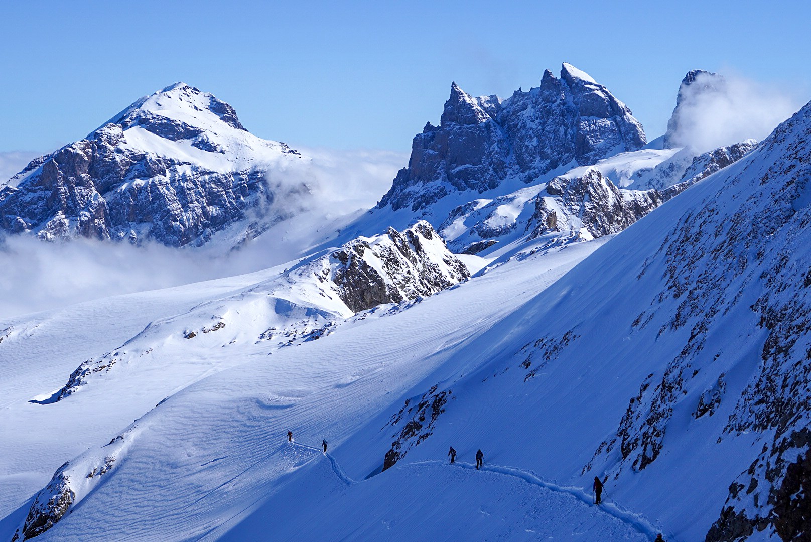
We decide to climb Grassen, a summit located at 2946 m, to enjoy the view of the imposing Titlis wall, and from up there, a magical landscape opens up, the summits being revealed by the sea of clouds which extends as far as the eye can see.
We cross on the side, until reaching a beautiful powder slope. We are reaping the rewards of the disruption of the last few days. Out of overzealousness, I find myself a little low compared to the ski track, which seems to pass through the middle of the cliff. I'm surprised at this failure.
We go up a steep and narrow slope, which gives us access again to the glaciers of this incredible suspended crossing, to reach the summit of Bärenhorn.
Below, the sea of clouds, still, under which we soon ski. Like the day before, visibility is reduced to zero, and I orient myself using GPS. The snow is getting heavier, and we have to stay at the bottom of the couloir to hope to avoid the tricky stones.
We still have to cross an almost completely snow-free moraine and make a long scraping crossing to finally reach the hut.
The surprise is rather good: if it is less cozy than the previous ones, it is on the other hand new and comfortable, and well stocked with beer. Perhaps just missing a wood stove which would have softened the rather cool atmosphere.
Wake up early, the first of this winter season. It smells like spring! At 5:30 a.m., we are on skis for a seamless warm-up, on an icy slope where we must not fall. Skidding for everyone!
I don't understand the track of ski touring indicated on the Swiss maps, which seems to be easy-going, but the terrain is quite different: steep, icy.
We reach the bottom of the valley and go up opposite, in the middle of a micro-ski resort. Quickly, we find very wild terrain and, as we rise, we have a breathtaking view of the Titlis and the crossing on the ridges of the day before.
From the Wissberg cross, at 2627 m, we could imagine continuing this crossing further north and reaching the Rugghubelhütte. But the day, for our part, is not over and we must find our cars.
After the descent to Engelberg, a bus transition in the valley allows us to reach the Engelberg-Titlis ski lifts. From Jochpass, at the top of the ski area, a long descent awaits us through Gental to the car.
What a day and what a crossing!
Portfolio
A ski circuit in the Uri Alps
LES GRANDS RAIDS À SKI